About Urbex Map
Urbex Planet is a community-driven map and platform for urban exploration and discovering abandoned places. Browse curated urban exploration locations (aka urbex locations), contribute your own pins, and connect with explorers.
Use the map to filter by category, status, and popularity. Whether you are looking for industrial ruins, historic sites, or modern derelict structures, you can find inspiration for your next trip.
How does the Urbex Planet map help explorers?
The Urbex Planet urbex map is a free discovery hub for public urban exploration pins, abandoned places, and community-submitted context. Use it to learn the shape of an area, compare categories, and decide what needs more research before you travel.
We keep public SEO pages safety-gated: they explain responsible research and link to public pins, forums, and resources without encouraging trespass or exposing unnecessary sensitive details.
Responsible exploration reminder
Urbex Planet is for documentation, research, and community learning. Follow local laws, respect private property, avoid active sites, never force entry, and do not publish details that could lead to vandalism or unsafe visits.
Top Abandoned Places in World
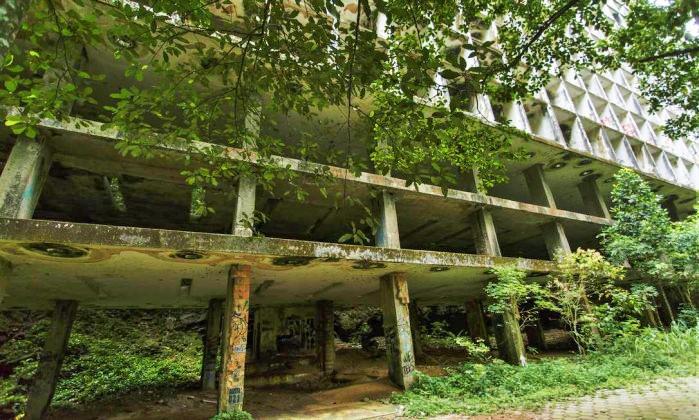
Skeleton Hotel / Ruinas do Hotel Gávea / Hotel Esqueleto
The Ruinas do Hotel Gávea, also known as the "Hotel Esqueleto" or Skeleton Hotel, is an unfinished 16-story luxury hotel complex abandoned in the heart of Rio de Janeiro's Floresta da Tijuca, near São Conrado and the iconic Pedra da Gávea, offering stunning panoramic views of the ocean and mountains. Designed in 1953 by architect Décio da Silva Pacheco as Brazil's most opulent resort—with plans for 440 rooms, a restaurant, convention center, sky terrace boate, and even a cable car system—the 30,000-square-meter structure, spanning 125 meters long and 50 meters high with 272 access steps, was halted by the bankruptcy of its developer, Incorporadora Califórnia, in 1972, leaving it as a raw concrete skeleton that never hosted a single guest. Over decades, the site fell into decay, serving briefly as a party venue in 1965 and later as a shelter for the homeless or criminal hideout, while rampant vandalism stripped its materials; today, it's a perilous urban exploration hotspot drawing adventurers for Instagram-worthy photos, though risks like structural instability and lack of oversight persist. In 2023, the property was acquired by GV2 Produção for revival as the compact Gávea Boutique & Extended Stay Hotel with 230 units, targeting a 2026 opening amid ongoing environmental and preservation debates.

Charles Camsell Hospital
The Charles Camsell Hospital was originally established in 1946 as a federally operated "Indian hospital" primarily for treating Indigenous patients from northern Alberta and the Northwest Territories for tuberculosis (TB). Owned by Indian Health Services until 1980, it exemplified segregated healthcare in Canada, with many Indigenous people isolated and subjected to experimental treatments, forced sterilizations, and reports of physical, mental, and sexual abuse. As TB rates declined in the 1960s and 1970s, the facility transitioned to a general provincial hospital after a rebuild in the late 1960s, operating until its closure in 1996. The site remained largely abandoned for decades, gaining a reputation as one of the most haunted locations due to its dark history. In recent years, ground-penetrating radar searches have been conducted for potential unmarked graves of patients who died there. The property has since been redeveloped into the Inglewood Lofts, a mixed-density residential community featuring approximately 594 units, including adaptive reuse of the main hospital building into 213 loft-style units, townhouses, a completed 101-unit seniors housing development, and plans for additional mixed-use elements like a public park and Indigenous memorial spaces.
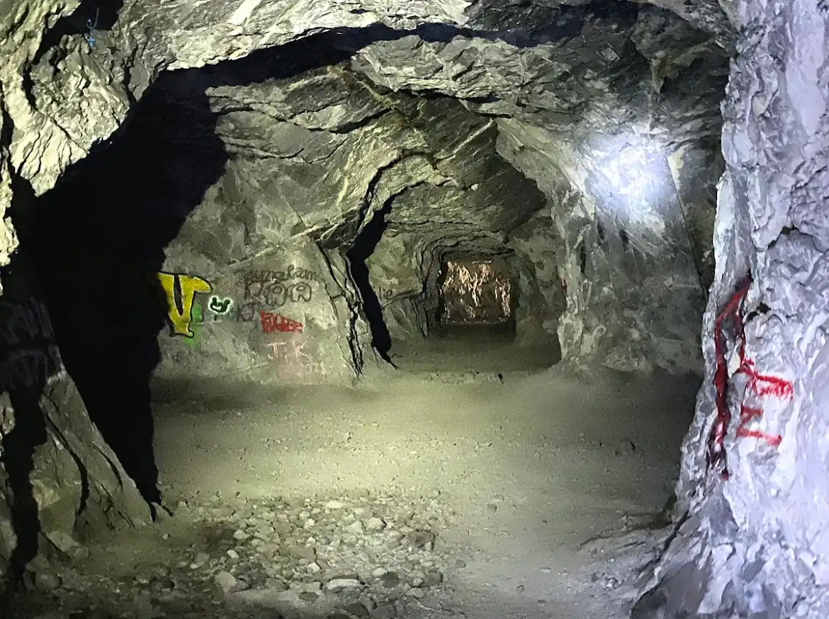
Heart Creek Bunker
A disused Cold War-era facility built into the mountains near Canmore, Alberta, intended to store important documents. Located along the popular Heart Creek Trail, the tunnelized bunker features an entrance and a main tunnel approximately 55 meters long, with a shorter side tunnel near the entrance. Visitors can access the bunker via the Heart Creek Bunker Trail, a moderate hike requiring a Kananaskis Conservation Pass.
Frequently Asked Questions
What is an urbex map?
An urbex map is an interactive map of urban exploration locations. On Urbex Planet you can filter by category, status, and popularity to find abandoned places and hidden spots.
How do I find an urban exploration map near me?
Open the Urbex Map and search for a city, coordinates, or allow location access to center the map. Use category filters like Industrial, Historical, or Hospital to refine results.
Do I need an account to use the map?
Browsing public locations is free. Creating an account lets you submit pins, vote on accuracy, save preferences, and access additional member‑only content.
Is the urbex map free?
Yes. Urbex Planet is a free community project with optional donations that support hosting and development.
How do I add a location to the map?
After signing in with Discord, go to Pins → Add New and fill in the details and photos. Editors review submissions and the community can vote on accuracy.